Headquarters
7150 Columbia Gateway Drive, Suite L, Columbia, MD 21046
New York Location
112 West 34th Street, 18th floor, Room 18025 New York, NY 10001

Proud member

3D wayfinding has become a welcomed technology for both facility managers and visitors. It helps visitors better navigate the area and find where they need to go creating an overall better visitor experience.
When organizations create positive visitor experiences it can lead to revisits, and referrals, reduce the need for customer service to help with wayfinding needs, and create happier customers.
Is your organization considering making the switch from traditional wayfinding maps to digital wayfinding? Are you interested in understanding the benefits and process of installing 3D wayfinding technology?
With the insights below we hope to answer all of your pressing questions. For more detailed installation information such as pricing, or to discuss customized solutions, contact the ITS team.
3D wayfinding offers an interactive experience that allows users to navigate using 3D maps. This 3D technology allows users to explore the map in a more interactive way, while also offering automatic route suggestions based on needs.
It is a wonderful technology that provides users with intuitive and interactive navigation experiences, but how does it work exactly?
1. The first step involves gathering detailed data about the indoor environment. This can include floor plans, architectural layouts, 3D models of the building, and even simplified maps like a printed brochure.
Because this is such an important part of mapping the 3D maps, companies like us at ITS will even offer to walk the facility and develop original floor plans to use to create the maps.
2. Once the data is gathered, it can be used within custom software that creates detailed digital maps of the spaces. These maps are often rendered in 3D, allowing for a more realistic and immersive navigation experience.
With our Navigo® software, it can also allow the organization to specify areas of interest such as attractions or bathrooms, map out handicap-accessible routes, and customize the interactive map based on select inputs.
3. With the information being mapped and data points input through the software, guests and users only need to input their destination or browse through available points of interest and the software does the rest on your end users mobile devices and your digital wayfinding signage displays.
Once a destination is selected, the software calculates the best route and displays it to the user. This can include step-by-step directions, points of interest along the way, estimated travel times, or handicap-accessible routes.
4. Future edits can be made to the maps as attractions change or as a facility makes infrastructure changes. Changes to the maps can be easily made if using a web-based wayfinding software like Navigo®.
Internal users can simply adjust points of interest, move or delete locations, or make other facility changes to the map. However, infrastructural changes that affect the layout of your campus or facility may require creating a new map entirely.
Navigo® 3D wayfinding software itself is a complex technology, but the process for organizations is easy.
Organizations from all types of industries can benefit from implementing 3D wayfinding software. Whether you have a complex facility, large campus, or just want to better help your guests navigate to where they need to go, digital wayfinding can help.
Because 3D wayfinding maps are created digitally, there’s a number of features and designs that can be created uniquely to meet any organizations style and needs.
Let's explore a few examples of 3D wayfinding software in action:
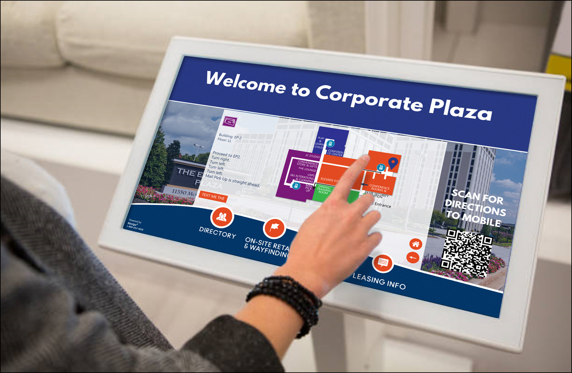
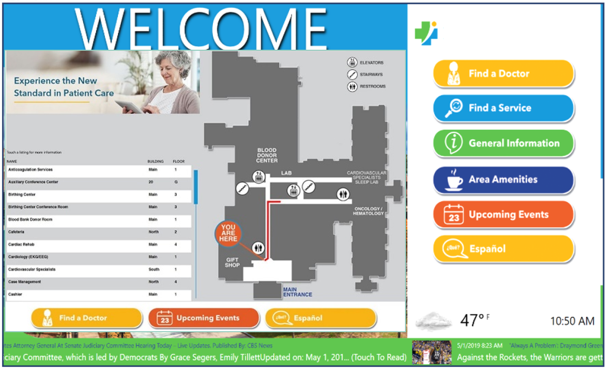
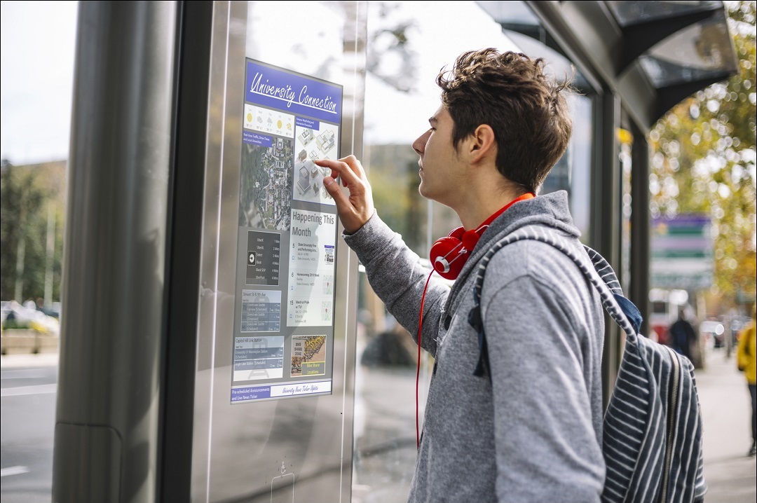
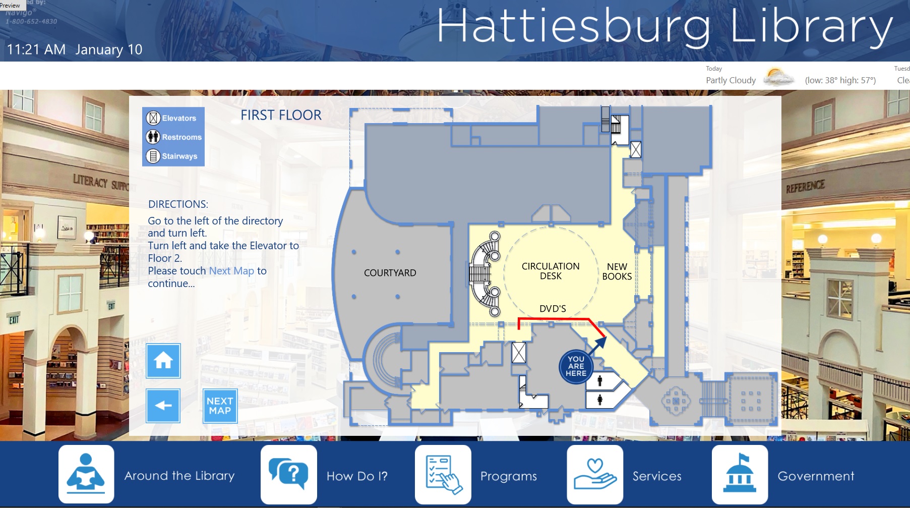
3D wayfinding can be ideal for a number of various industries and situations.
From corporate offices to entertainment venues to tourist attractions, organizations of all sizes are adopting digital technology like 3D wayfinding over traditional methods to enhance the overall visitor experience.
The installation process of 3D wayfinding systems can be fairly straightforward, but it can take several weeks based on the complexity of the project. To help provide you with an understanding, we highlighted what the process will look like.
Step 1. The Initial Consult and Planning: The software provider assesses the indoor space, gathers relevant data, and plans the mapping process.
Step 2. Data Integration: The client will need to provide existing architectural data and/or floor plans to the software provider to integrate into the software. If the organization does not have an up-to-date map or floor plans, the software provider may offer the option to create one for the client.
Step 3. Software Configuration: Based on the initial plan, the software is used to customize the maps and wayfinding system to suit the specific needs discussed with the client. This is to be reviewed to ensure proper functionality and that the 3D wayfinding system matches the client’s specifications.
Step 4. Hardware Setup: Once the maps have been created digitally, the hardware components such as digital displays or interactive kiosks can be installed. The digital wayfinding installation company will provide all parts and handle the entire installation.
Step 5. Testing and Calibration: After the hardware has been installed, the 3D wayfinding map software needs to undergo rigorous testing and calibration to ensure accuracy and usability. This is also an ideal time to test the interface on the display with real life proportions to ensure the look and feel matches the initial plan.
Step 6. Training and Launch: As a final step of the installation process, the client’s staff is trained on how to use the system. This can include training on both the content management software and how to navigate the maps from the end user’s perspective.
The installation process in total can take as little as 2-4 weeks to complete for simple projects. More complex projects with custom API integrations, custom enclosure designs or other unique requests can take several weeks longer to complete.
To get a full understanding of 3D wayfinding software installation, features, pricing and other information, connect with a digital wayfinding company who offers 3D mapping solutions.
Explore itouchinc.com for more information on our solutions or contact us for needs unique to your property or project.
7150 Columbia Gateway Drive, Suite L, Columbia, MD 21046
112 West 34th Street, 18th floor, Room 18025 New York, NY 10001

Proud member
Toll-Free
Phone
© Copyright 2026 ITS, Inc. All rights reserved.
Stay in touch with the latest news and updates from ITS, Inc.
7150 Columbia Gateway Drive, Suite L
Columbia, MD 21046
112 West 34th Street, 18-025
New York, NY 10001